INSEE has published figures showing that almost 75,000 inhabitants have left Paris between 2014 and 2020. Many interpretations of this figure do not consider its context. To be intelligible, demographic data must be analysed over the long term. It is also necessary to study the precise territory in which it is collected. Finally, the data must be related to the population density in the area concerned.
Demography is not a short-term science. It identifies major trends, the causes of which are multiple. There will be more inhabitants in Paris in 2020 than there were in 1999. Between 1968 and 1999, the Parisian population constantly decreased, then increased between 1999 and 2013, then decreased again between 2013 and 2020. And if we extend the period studied, Paris had almost 3 million inhabitants at the beginning of the 20th century and has therefore lost 760,000 inhabitants in a century, i.e. a quarter of its initial population (Table 1).
Table 1 : Population trends in inner Paris from 1921 to 2020

The long term
For the past forty years, the population of Paris has thus hovered around an average of 2.2 million inhabitants, and according to INSEE, this situation should last until 2050. In a note entitled La population de Paris à l’horizon 2050, the Institute estimates that Paris will have 2,233,000 inhabitants in 2050, a level close to that of 2013. The note specifies ‘that in 2050, according to the different demographic scenarios envisaged, the Parisian population would be between 2,155,300 and 2,325,400 inhabitants… The demographic decline that began in 2011 would continue until the middle of the next decade. The population of Paris would thus rise to 2.18 million inhabitants in 2024. Then, the capital will return to demographic growth and, by 2050, will be back to its 2013 level. This long-term stability of the Parisian population contrasts with the evolution of the population of the inner suburbs which, over the same period, would increase by 15% and that of the outer suburbs which would grow by 17%1. The decline in the Parisian population, which began in 2013, is explained by a negative migratory balance which is not sufficiently compensated for by the natural surplus of births over deaths.
In a century, Paris has therefore become less dense and there are many reasons for this. The main one is the decrease in the size of households, itself due to the drop in the birth rate and the increase in separations and divorces. We have thus moved from a lifestyle where, in one flat, there was often one bedroom for two or even three children, to one where, in two different flats, there are two bedrooms for the same child. Household size fell from 2.35 persons in 1954 to 1.87 in 1999 and has remained at this level until 20192. Just over half of all households are single-person households, and single-parent families have increased from 7.5% of households in 2008 to 8.3% in 2019.
If there are more families with children in the inner and outer suburbs than in Paris3, this is primarily due to the difference in the size of the housing. More than half of Parisian homes have a maximum of one or two rooms, compared to less than one in four in the rest of Ile de France4. This difference in housing size explains why families are “driven” from Paris to the suburbs when a second or third child is born. As the Apur notes: “In fact, if property is expensive, it is, among other things, because the demand that comes from the natural growth of the population is stronger than the supply that results from the evolution of the stock. It is therefore not the high cost of property that leads to emigration, but demography that contributes to the high cost.”5
The second cause of de-densification is the decrease in the number of primary residences in Paris (Table 2). Between 1968 and 2019, the number of primary residences fell by 15,194, while the number of secondary residences increased by 103,218 and the number of vacant dwellings by 79,396. In other words, the 167,421 new dwellings created between 1968 and 2019 did not benefit Parisians, because of vacancies and second homes. This phenomenon has accelerated over the last ten years, with the development of platforms such as Airbnb. There has been a spectacular increase (+55%) in second homes and occasional accommodation between 2008 and 2019. If we add to the 120,295 empty dwellings, the 131,320 dwellings listed as second homes, it is as if two large arrondissements (ditricts) of Paris, the 16th and 17th, for example, had no Parisians living in them.
Table 2 : Distribution of the number of dwellings in Paris according to residence status between 1968 and 2018 (in thousands)


Relevant territories
When looking at urban demographic trends, the question to ask is that of the relevant territory. The fact that a family moves from Paris to Pantin is measured statistically because there is an administrative border between the two cities, but the urban area, the employment basin, the space and lifestyle, and the means of transport are the same. This means that the administrative territory of the city of Paris is not relevant. It is the area of economic activity, the employment area and the urban continuity that count. The significant perimeter is the urban unit of Paris, which designates, according to INSEE, all the municipalities with a continuity of built-up areas around the city of Paris. This urban unit will have 10,858,874 inhabitants in 2020 over an area of 2,853.5 km², i.e. 24% of the Ile de France region. It is the most populated in the European Union.
It is the right scale to judge the influence of a territory and the link between economic growth and demographic dynamism. Within this economic area, population movements are an indicator of the choices or constraints of the residential pathways of families and companies, but not of the attractiveness of the territory. It is not because Paris Intramuros is losing 75,000 inhabitants that Greater Paris is losing momentum. On the contrary, its attractiveness has been growing since 2008, as all the available international rankings show, as has its demographic development. In a decade, Paris has lost inhabitants, but Seine Saint Denis has gained some (the department will have 1,700,000 inhabitants in 2020). And the Urban Unit, like the whole of Île de France, grew by 0.4% per year between 2013 and 2018 (Table 3).
The Parisian paradox is that none of the three existing administrative territories is relevant. Neither the city with its 2.1 million inhabitants, nor the Region (12 million), nor even the Greater Paris Metropolis (6.7 million), correspond to the Paris Urban Unit of 11 million inhabitants, which covers the dense zone, i.e. the part of Ile de France that is neither rural nor rurban. Even the notions of Petite couronne (departments 92, 93, and 94) and Grande couronne (departments 77, 78, 91, and 95) are misleading since the 5.4 million inhabitants of the Grande couronne are divided between the Urban Unit (4 million) and the rural Ile de France (1.4 million). Ile de France is the fifth largest agricultural region in the country, and 75% of its territory is rural, according to INSEE. This mismatch between administrative territory and economic and demographic territory is a handicap for the metropolis, as it is one of the causes of its poor governance6.
Table 3 : Distribution of the Ile-de-France population by geographical area in 2019 (in millions)

Table 4 : Population variation 2013/2018 (%/year)

Desirable densities
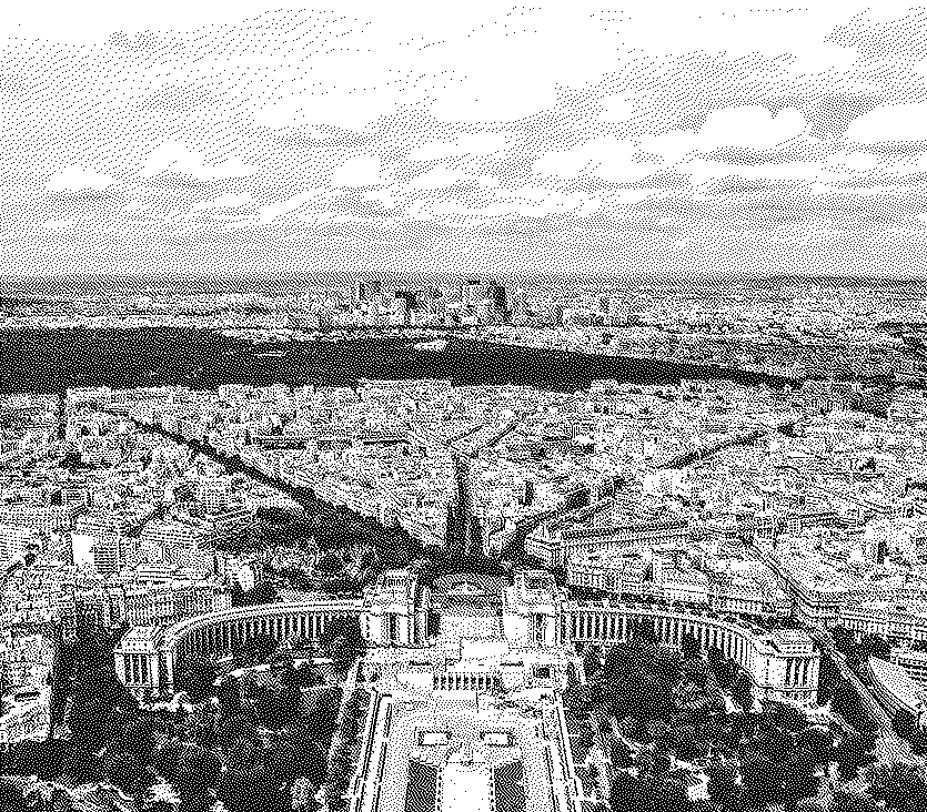
Finally, if we want to understand the demographic dynamics of the conurbation and draw lessons from them for a spatial planning policy, we need to look at the differences in density within the area under study. Is there a desirable distribution of the metropolitan population within its territory? And how can it be achieved? The density of Paris is 20,641 inhabitants per km2 (25,200 if the Bois de Boulogne and the Bois de Vincennes are not included). It is the densest city in Europe and the 7th densest in the world. The rankings differ from one source to another. For Worldatlas.com, Paris only comes in 34th position, but this ranking mixes small and large cities. If we look only at large cities (more than 2 million inhabitants) and leave aside the case of the Manila agglomeration, which is made up of several dense cities, Paris is in 7th place, behind Manila, Baghdad, Mumbai, Dhaka, Karachi, and Calcutta, but ahead of Delhi, Shanghai, Tokyo and New York. In some rankings, the density of Paris is measured without the woods (Boulogne and Vincennes), which makes it the 5th densest city in the world, ahead of Calcutta and on a par with Karachi.
But even in the small area of Paris (105 km2), there are significant differences from one arrondissement to another. The 11th arrondissement is the densest with 39,566 ha/km2 – which puts it just behind Manila (46,178)! – while the 16th arrondissement is the least dense with 10,111 ha/km2. This diversity is reflected in the neighbouring communes. Some of them are denser than Paris, it is the case of Levallois, Vincennes, Le Pré Saint Gervais, Saint Mandé and Montrouge (from 24 to 26,000 ha/km2 ), while Clichy, Courbevoie and Boulogne are just behind Paris (around 19,000 ha/km2 ).
While others have a very low density, Saint Cloud for example with 3969 ha/km2, Ville d’Avray (3058), or Rueil-Malmaison (5 327). The “Petite couronne” (Inner suburbs) has an average density of 7,077 ha/km2 and the “Unité urbaine” (Urban economic zone) de Paris 3,790 ha/km2. But these averages hide considerable differences. This is what makes the issue of densification so complex, which is posed differently from one district or suburb to another. In addition, there is the gap between reality and the feelings of the inhabitants who are already there.
Table 5 : Density of the different geographical areas of Ile-de-France (in inhabitants/km2)

20,000 (Paris), 7,000 (inner suburbs), 3,700 (conurbation): these density figures must be kept in mind to understand the issues at stake in the Greater Paris dynamic, whether in terms of social cohesion, urban integration or economic development. Paris is very dense and cannot become any denser. This is what the INSEE projections show: in 2050, Paris will have more or less the same number of inhabitants as in 2013 or in 1982, i.e. almost stable over nearly 70 years.
On the other hand, stability does not mean immobility7: we must continue to transform Paris by favouring the rehabilitation of buildings rather than demolition-reconstruction. And if we wish to give an urban form to Greater Paris, it is essential to develop the gates of Paris by transforming them into places of Greater Paris, new centralities for a polycentric metropolis. To achieve this, the boundary of the Périphérique (Ring Road) must be erased and the monopoly of the car on surface traffic must be broken. The development projects around the Périphérique provoke violent conflicts, but we must put things in their place: the Bercy-Charenton project, which was abandoned because of “excessive densification”, planned the construction of 4,000 housing units, i.e. an increase of 0.0028% of the number of housing units in Paris. The density of the project was less than 11,500 ha/km2 compared to the 15,600 ha/km2 of the city of Charenton, which adjoins it. The question that must be asked is: what is the minimum density to create urban continuity and a living space between Paris and its suburbs, and to erase the urban highway that is the Périphérique? The paradox is that maintaining the void is tantamount to making the motorway a sanctuary. From this point of view, the case of the Porte de Montreuil is exemplary. This is an urban space that is about the same size as the Place de la République. What would the Place de la République be without buildings around it? The answer is simple: an urban wasteland, conducive to delinquency.
Once you cross the Ring Road, the density of the inner suburbs is a real mosaic. The potential of a territory is often undermined by barriers, whether physical, such as an urban motorway, a railway line, a river, an airport, or institutional, such as an administrative division. It is in these border zones that territories suffer, like Paris with its Ring Road. This patchwork of the inner suburbs is the result of a lack of connections between territories, the multiplication of impassable borders and the absence of coordinating policies at the scale of the dense zone. In the 1960s, when the policy of new towns was launched, the State ignored the inner suburbs and created five towns in the outer suburbs from scratch: Evry, Cergy-Pontoise, Marne-La-Vallée, Sénart and Saint-Quentin-en-Yvelines. The attractiveness of the Paris Region was described as based on an archipelago made up of Paris, La Défense and these new centralities in the outer suburbs, obscuring the role of the inner suburbs. Despite their proximity to Paris, these territories were excluded from the agglomeration effects and were treated as servants’ territories, whose mission was to accommodate all the urban services that Paris did not want to burden itself with: cemeteries, waste treatment plants, bus garages, garages for dumpsters, impoundments, etc. Fortunately, spontaneous urban dynamics eventually caught up with state planning, and the inner suburbs experienced spectacular successes, such as the development of the Plaine Saint-Denis.
This history explains the complexity of implementing a policy aimed at better balancing densities between the territories of the metropolis. This rebalancing would make it possible to fight against urban sprawl, which contributes to the artificialization of land, encourages intensive use of the car, contributes to the breakdown of social ties and ultimately to global warming. The yellow waistcoat movement was also a symptom of uncontrolled and even encouraged urban sprawl, generating relegation and abandonment. This means that on the scale of Greater Paris, densification is a necessity, both for the preservation of agricultural land and green spaces and for low-carbon mobility. This is as much a matter of urgency for the climate as for social cohesion.
This densification must be carried out while respecting all existing urban forms without destroying them, and in particular the landscape of the pavilions which is part of the identity of the Metropolis. A recent study8 has shown that it is possible to densify housing without disfiguring it, if it is done with sensitivity and in partnership with the owners of the houses. Here again, statistics are essential. Individual housing represents the most important part of the urban space in Greater Paris, 93,000 hectares or 36% of the territory. The 1.4 million small owners are mostly aged 55 and over, and 50% of houses are occupied by only one or two people, due to the departure of children. In a note for La Grande Conversation, entitled How the small suburban homeowner can solve the housing crisis, Lily Munson explains that the solution is not to demolish suburban housing by driving out homeowners and building blocks of flats that distort the urban landscape. Rather, the solution lies in a simple intensification of the 60 to 100 m2 pavilion, in partnership with the owner, without increasing the land area of the building. Such a strategy represents a potential of 140,000,000 m2 of building space! It seems possible to densify Greater Paris without disfiguring it.
The implementation of the Grand Paris Express may be an opportunity to improve the porosity and cooperation between the cities of the dense zone, as this network is not only a mobility project, but also an urban planning project. By shortening distances, it will transform the spatial representations and urban practices of millions of inhabitants. The “Parisian” proximity, that which we evaluate, without even thinking about it, between two metro stations, will be able to be extended to the whole of Greater Paris: The Grand Paris Express station at Bagneux and the Denfert Rochereau station in Paris will be equidistant (in terms of travel time) from the Porte d’Orléans. For example, hundreds of thousands of students will be able to get to their university in half an hour, compared with an hour and a half today. This is not just a time saving, it is a change of world. And the densification of the neighbourhoods around the new stations is a key condition for the success of the project. For this new network to play its full role, it must polarise pieces of dense city combining housing, economic and commercial activities, and it must participate in the rebalancing of jobs and housing between the West and the East of Greater Paris.
So, should we be worried about the decline in the population of Paris? Certainly not. It would be a different matter if the population of the Urban Unit were decreasing, which is clearly not the case. We must be concerned about the imbalances in population density within the dense zone, as well as the imbalances in jobs/housing between the territories, and act to correct them. The ideal density of Greater Paris is a common metropolitan good and should be the subject of shared governance at the metropolitan level. A metropolitan urban strategy is possible to increase density without disfiguring, to connect without standardizing, it requires both a political will and an adapted governance tool.